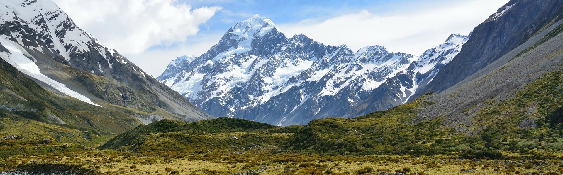
Tips for planning your TA hike
When we set out planning for our TA hike we found a lot of information strewn all over the web. What should have been simple, quickly answered queries resulted in us spending hours glued to our screens in a YouTube vortex. So below is some info that we feel will be helpful in planning your TA hike.
If you would like further details on any of the topics we have covered or you would like us to include additional info, please reach out to us as we are more than happy to help.
We have also put together a list of TA FAQ’s that you might want to check out if you have a few lingering queries.
Contents
The TA as a thru hike
Budget
Donating to the TA trust
Camping on the TA
Direction, South or North?
Best time to hike the trail
Resupply
Permits
Weather
Navigation
Getting to the start of the trail
Paddling the Whanganui River
Cycling the Timber Trail
Hazard Zones – The Rangitata and Rakaia rivers
Gear setup
Replacing Gear on the trail
Bounce boxes
Mobile phone plans in NZ
Using the NZ hut system
Other information Sources
The TA as a thru hike
Rather than approaching the TA like a traditional ‘thru-hike’, we saw it as an adventurous way to discover the incredible country that is New Zealand. We took a ridiculous amount of Zero days exploring small towns and eating ice cream a every available opportunity, went caving in Waitomo, took a week off in Paekakariki over Christmas to explore the Kapiti Coast, explored numerous side trails and hiked a few of the Great Walks including the Kepler, Routeburn and Raikura Tracks.
If you have been doing some research on the trail you have probably heard a lot of chatter about road walking. Opening in December 2011, the TA is a young trail, and with that not only comes the chance to explore something new but the glitches and hiccups that are inherent in any new venture. Whilst the TA Trust has a goal to reduce road walking to less than 5% of the trail, there is currently a significant portion of the trail which is not through ‘wilderness’ and uses roadways to get from A to B. Your attitude, approach and reason for undertaking the trail can have a significant impact on your enjoyment of it. If you have the goal of walking every km of “the TA” by foot, kudos to you but know that the TA changes constantly, not only year to year but during the hiking season. We hiked the trail in 2018/19 and the maps changed 4 times that I recall (during the season). Know that the TA which you hike is different to the original trail which will be different to the trail someone hikes who starts a month after you. If you have the goal to walk end to end New Zealand by foot, then again, kudos to you but be fully prepared upfront to walk a few hundred km’s along highways and roads in often dangerous traffic conditions. Know that it is not the intention of the trail makers to have you out there hiking that specific piece of tarmac. It is only a solution to a short term problem of perhaps, not having access rights through private land. Our approach was to hike all sections of actual trail and hitch around any roads we felt like hitching around (some of the small quiet roads turned out to be quite pleasant walking). In reality, we had as much fun hitching as we did out hiking. Wet met incredible individuals who we’d never otherwise met and experienced true Kiwi hospitality and friendliness.
We found that purists or people with a traditional ‘thru-hiker’ mentality generally struggled with the road walking, torn between skipping sections of ‘trail’ and walking along roads and highways they hated walking on. Everyone has their own reason for hiking the trail but I would encourage you to fully understand why you are walking the trail and what you need or want to get out of it before committing to hike it. If you are someone who has triple crowned in the states and is looking for the next thru-hike to tick off your list, you probably aren’t going to enjoy yourself. If you are someone who has a flexible approach to adventure and is up for a challenging way to travel New Zealand including biking, hiking and canoeing then you will probably love it.
We met numerous people on the trail who were not enjoying their experience, were speaking badly about the trail and the Trust, constantly complaining about trail conditions but continued to push through regardless. I could never understand why. The TA is an expensive undertaking and the best part of 6 months of your life, if you aren’t enjoying it, your time and money is best spent doing something you love.
Our TA experience was one of the best 6 months of our lives. We loved it, inclusive of the thigh deep mud, goat track trails and bushwhacking through overgrown paths. Fully embracing the TA for all that is, you learn to appreciate its beauty, ruggedness and uniqueness.
Budget
We have intentionally discussed budgeting straight off the bat. The TA is an expensive trail, more expense than we expected and more expensive than most people expect. The TA isn’t a trail you can do on a shoe string budget and people who are attempting to do so are putting the future of the trail at risk by illegally camping or camping in areas where the TA trail notes specify that camping is not allowed, such as in public parks or on private land. This is not the PCT, there is no all encompassing permit which allows you to camp wherever you like along the trail corridor. Some budget driven TA hikers have also been found staying in huts without paying their fees and then there is the matter of donating to the TA trust. Donating to the trust is a non-negotiable as far as we are concerned. The TA is doing an incredible job developing the trail, providing comprehensive resources (free of charge) managing relationships with private landowners and dealing with an overwhelming increase in the number of hikers year on year.
How much did we spend?
We spent more than most hikers would spend on the trail, around NZD$12-15,000 each. This included 2 weeks of travel and hiking at the end of the TA, a week off in Wellington over Christmas, a bunch of side trails, a double zero in almost every town and gear hire for cycling and paddling multiple sections of trail. As previously mentioned, we treated the TA as an adventurous way to see New Zealand rather than a traditional ‘thru hike’.
How much do most people spend?
The TA trust recommends a budget of no less than NZD$5-7,000 and an average spend of NZD$7-10,000. Based on the people we hiked with on the trail we would estimate the average spend was around NZD$10,000 per person.
Why is the trail so expensive?
On the North Island the trail passes through a lot of towns so there are plentiful opportunities to spend money through eating out and indulging in things such as ice cream or espresso. As food lovers, this is a great thing. With the trail going through so many towns it also means that there are many sections of the TA where your only option is to pay to camp at a holiday park. As a couple this was usually upwards of NZD$40 per night, as you can imagine, it adds up quickly.
On the South Island the trail will more often than not deposit you into tourist towns where the accommodation options are usually booked up and super expensive (yes, even the camping options). Prices of food both at supermarkets and eating out are generally more expensive.
It is also worth noting that we found the cost of groceries to be more expensive in New Zealand than what they were at home in Australia. Particularly when it comes to fruit and veg (surprisingly a lot of which is imported) and dairy! The dairy was the real shocker, to this day I still remember spotting a 200g packed of organic Hallumi cheese priced at $14 which at home I would pay $7 for the EXACT same cheese. Why? I hear you ask. To get an impassioned answer ask a Kiwi over the age of 55 and they will let you have it but the short answer is, because there is a high global demand for NZ dairy the poor kiwis end up paying export prices for their own products.
Have a shoe string budget and still want to hike the TA?
Unless you hike the trail in record speed, have the appetite of a mouse, or are happy to section hike we suggest pushing your plans back a year, working hard and saving some extra cash before attempting the trail.
The TA trust, ‘respectfully suggest’ that if you wish to hike the trail on a small budget (i.e. less than NZD$5-7k) the Te Araroa may not be appropriate for you. We concur with the Trust. It is not OK to put the longevity of the trail at risk because you didn’t quite hit your savings goal and want to push ahead and hike the trail anyhow. Don’t be that hiker who ruins the trail for the hikers that follow them.
Donating to the TA trust
Briefly touched on above, the Te Araroa Trust do an incredible amount of work with stretched resources and a small team. They manage everything from revisions to trail notes to managing integral relationships with private landowners. Donating to the trust really is a non-negotiable, without the we wouldn’t have the TA. Yes, the TA has it kinks and it is still developing as a trail, the TA are working to iron out these kinks and without funding they won’t be able to do so.
When you go to make your donation think about all of the resources the trust are providing you with, topo maps, gpx files, trail notes, safety info, real time updates on trail conditions while you are out on the trail, they even have a navigation app now and this is all done without continued government funding.
How much should I donate?
When we hiked the trail in 2018/19 the TA was suggesting a donation of NZD$250 per hiker per island. So for a thru-hike that’s NZD$500.
Camping on the TA
The TA isn’t like the PCT where you can obtain a permit which allows you to camp anywhere along the trail corridor. Below are some points you will need to take into consideration.
Private Land
The trail runs through a lot private land on the North Island including sheep and cattle farms and even a manuka honey farm. The TA trust has spent years establishing and building relationships with the owners of the land in order to grant us access to walk across it as TA hiker. As such, the owners have certain conditions set out under which they grant us access to their land. One of these conditions is almost always no camping. It is therefore very important to clearly read the trip notes for each section and understand where you can and can not camp along the trail. This is crucial to the longevity of the trail.
Tourist areas and booking ahead
When we hit the tourist towns of the South Island such as Lake Tekapo, Queenstown and Wanaka we found accommodation to be heavily booked, including campsites. Although I’m not one for excessive planning and structure, we found it less stressful to book our accommodation in advance where we could on the South Island, say a week or two weeks ahead depending on how confident we were with our timing.
Holiday Parks
Don’t expect to be camping in the wilderness every night, particularly on the North Island. You will be spending a number of nights in holiday parks and DOC campgrounds. As mentioned in our budget section above, for the two of us this was usually around NZD$40 per night so it adds up quickly.
Direction, South or North?
We, like most TA thru-hikers, walked the trail Southbound. The trail can be hiked in either direction. TA trust recommends hiking Southbound starting in Cape Reinga in October/ November so you can hike through the South Island in the ‘optimal period’.
If you choose to hike Northbound, one downside is that when you reach the Whanganui River Journey you will have to flip north and paddle south down the river. Obviously paddling upstream through rapids isn’t really an option.
The other downside to hiking Northbound is that the TA Trust is yet to produce the trail notes for Northbounders. This isn’t a major issue but will obviously mean a little more work with your planning.
When we hiked the trail in 2018/19 it was estimated that 1,000 thru-hikers hiked the trail and up to 2,000 hikers were on the trail throughout the season including section hikers. So, yes, the trail is getting busy but it isn’t busy enough to hike Northbound simply in an effort to avoid a ‘bubble’ like some hikers do on the PCT.
I would recommended letting your direction be dictated by whatever start date suits you best. For us, that was October and we were lucky it worked out that way. Perhaps if you can not start until December / January consider hiking Northbound.
Best time to hike the trail
Southbound
October to March is the best time to hike the trail Southbound. We hiked Southbound and started on the 17th October. We found this to be a great start date as it gave us enough time to finish the trail without rushing, it wasn’t too far into summer so it wasn’t too hot when we started out, lambing season had ended so we didn’t have to worry about route closures and we avoided the high September rainfall.
It isn’t advisable to start earlier than late September due to lambing season closures. There are many sections of trail on the North Island which run through private sheep farms. These farms close hiker access while their sheep are giving birth to reduce stress on the animals. Starting earlier would mean navigating these closures. We also found it lovely to see all of the fresh new baby lambs frolicking around the paddocks.
Heading South you won’t want to start any later than December in order give yourself enough time to complete the trail by mid April, this is when the weather will start to close in on the South Island.
Northbound
December to early January is the ideal timing for a Northbound start to avoid serious cold weather and snow. There are lambing season closures in place in Southland from August until mid November, so starting Northbound earlier than mid November is not advised.
Resupply
Rather than give you a detailed list of everywhere we resupplied, we have outlined our general resupply strategy. We aren’t into re-inventing the wheel, if you are after a comprehensive list of resupply points on the TA, Brad McCartney AKA Shepherd has written one on his blog, Bike Hike Safari.
Our Strategy
We chose to primarily resupply along the trail rather than send ourselves boxes. We only sent 2 boxes on the whole trail. We believe this strategy works well for anyone who doesn’t have a severe dietary restriction. I am a vegetarian and never had an issue resupplying along the trail so unless you are vegan celiac who is allergic to nuts, you should be fine. We preferred this strategy over sending boxes for the following reasons:
- Cheaper. Yes, some of the small/ tourist towns you go through might be on the pricey end but the postage costs and food wastage incurred when sending yourself packages will far outweigh the higher grocery prices.
- Food wastage. I really hate seeing food wasted. Yes, you can put your unused food into a hiker box but there isn’t one in every town on the TA and most of the time that unlabeled snap-lock of your weird concoction won’t look so appealing to other hikes and will just end up a powdered mess in the bottom of a hiker box and ultimately in the bin.
- Supporting small towns and small retailers. Buying from mum and dad owned grocery stores along the trail has a two fold beneficial impact. Firstly you are injecting a little bit of money into a small town and small business who really need it and secondly, you are encouraging those business to stock hiker friendly products so year on year they are more likely to improve their range of hiker friendly options.
- As the TA is still young and developing it’s trail angel network, there may not be a post office or trail angel to send your package in every town. It would be time consuming to organise this ahead of time.
Where do I need to send a box?
While we suggest resupplying on the go, there are a couple of places along the TA where it is best to send yourself a resupply box, these are on the South Island. We sent 2 boxes during the entire trail.
- St Arnaud – I would highly recommend sending a box here, the only option in town is a petrol station which has limited options. You could definitely get by with resupplying there if you had to but given you will be resupplying for a long/ tough section of the trail you will appreciate a good resupply box.
- Boyle Village – We sent a box here as we weren’t originally planning to get off trail. If I had my time over I would not send a box here and would recommend that unless you are super tight on time and budget you get off trail and hitch into Hanmer Springs and resupply there. The lady who runs the youth camp was a little jaded and had seemingly encountered a bad experience with TA hikers in the past so she treated us with skepticism. We also heard a rumor that she was taking items out of the hiker box and selling them in her store which did not sit well with us. Aside from this, I would highly recommend a visit to Hanmer Springs for some R&R and a soak in the hot springs. The supermarket in Hanmer Springs was fairly well stocked and although small, had a good range of hiker food.
A lot of hikers also sent a box to Pelorus Bridge Campground. Because we were arriving there over new years we were unsure if our box would make there before we did. We took a risk and did a 10 day resupply from the small supermarket in Havelock. We were pleasantly surprised at the range of hiker food the supermarket had available and had no issues resupplying here. It was a lot less stressful than trying to send another box.
Permits
You do not need to apply for a permit to hike the trail however you do need to:
- Register with the TA trust;
- Commit to the trail pledge; and
- Donate to the TA trust.
In saving that, there are a couple of sections of the trail where you will need to either book or register;
The Queen Charlotte Track
When we hiked the trail in 2018/19 there was no need to pre-book campsites however to hike the Queen Charlotte Track you are required to purchase a pass. You can buy these online, in Picton or on the track itself, however, we found the easiest way to buy our pass was through Beachcomber Cruises who we also used to transfer us to Ship Cove, the start of the trail. Beachcomber offer one way cruises to Ship Cove and they also offer a discount to TA hikers. The boat ride over to Ship Cove was more than I expected, it is a scenic tour complete with knowledgeable commentary on the beautiful sound. We simply called them to book in a couple of days beforehand and then paid for our the cost of the boat transfer and our QCTLC pass before we boarded the boat.
It is also worth noting that there are fees payable at most of the campsites along the trail which need to be paid in cash. Backcountry hut passes do not cover these sites, so be sure to carry enough change with you.
When we hiked the trail there were rumors of the Queen Charlotte Track being turned into a Great Walk. That hasn’t happened as yet, however, it would be worth keeping an eye on it, I expect that it would mean a need to pre-book campsites if it were to happen.
The Whanganui River
You will need to organise canoe hire and book your campsites prior to setting off down the river. We went with Taumarunui Canoe Hire for our journey. We booked the canoe hire and our campsites through the i-Site in Taumarunui. You can however book your hut / campsites directly with DOC. The i-Site was super helpful, we primarily used them as we needed help planning around a bad patch of weather that was due to hit when we due to hike the Tongariro Alpine Crossing. We ended up extending our Whanganui River paddle and starting out from Taumarunui. We then flipped back up when we reached the town of Whanganui and crossed Tongariro in good weather. We were very happy we did it this was and would highly recommend extending your paddle to start from Taumarunui if you have the time and budget.
Weather
The weather in New Zealand is no joke, it is nothing like the weather in Australia or the U.S. where you have well defined seasons and predictable weather patterns. Know that you can encounter strong winds and big rain fall at pretty much any time of the year. The weather changes rapidly as does the forecast, you need to keep an eye on the weather forecast and re-download it whenever you hit a patch of cell reception, particularly through the more weather critical sections such as the Tararua’s or Richmond Ranges, you will learn to do this as you go.
We mainly used the Metservice app for our weather forecast. They have specific mountains and parks forecasts which are really helpful as we all know the weather in town can be completely different to the weather up in the mountains so be sure to check those out. They also do 3 day synoptic charts and rain radars which are invaluable when there isn’t a specific forecast for the area you are travelling through. You can use these tools to clearly see where an incoming weather pattern is heading. But above all learn to take advice from locals. We found the local Kiwis to predict the weather better than the forecasts, not because Metservice don’t do a good job, but because the weather patterns in New Zealand can be extremely localised. Kiwis are a chilled bunch of people who tend to understate things so know that if a local tells you bad weather is coming, bad weather is coming!
The wind can be fierce in New Zealand, so much so that it has been known to blow people off mountains and trails. I am not telling you this to scare you but to inform you so you know to treat mother nature with respect. We encountered a couple of seriously strong winds on our TA hike, none of which were in dangerous areas but it was enough to scare us in to taking the wind seriously.
As mentioned above, the rain is serious in New Zealand. When it rains, it rains hard and that means that rivers and canyons tend to flood quickly. There are numerous river crossings on the TA which need to be treated with respect. We are not going to detail them all here. They are noted in the TA trail notes. When you have upcoming river crossings in a section, be aware of what the weather has been doing, what it is doing, and what it is forecast to do. Speak to locals in the know, including DOC rangers who will be able to provide safety guidance.
During our hike we decided to take some time out in Christchurch when the Deception River was flooded for nearly a week. This is all part of trail life, learning to take things as they come and adapt to what mother nature has in store for you.
Navigation
Our main tool for navigation was the Guthook app, it makes navigation easy and we highly recommend it for anyone hiking the trail. Guthooks uses the GPS on your phone to locate your position on a detailed map, of which you can choose the style. We found it particularly helpful in areas such as the Raetea Forest where there were multiple trails all marked with the same orange triangle and the direction is unclear. I dare say it made navigation idiot proof. The app can be used with your phone in flight mode, once you have downloaded the maps your phone does not need to be online to access them. The app has way points plotted where you can comment and read other hikers comments to get fairly up to date information on anything from trail conditions to water source quality to where to stay and eat in town.
Whilst we primarily used Guthooks to navigate but heavily used the trail notes and topo maps provided by the TA trust for planning and information gathering. I really enjoyed reading about the areas we were hiking through and they also clearly outline where you can and can not camp. They also provide resupply information and town amenities as well as listing the details of local trail angels and hiker friendly services. They really are a must. The TA isn’t like the PCT where you can simply hike as far as you can for the day and call it quits when you get tired, you need to plan out your campsites for each upcoming section. We preferred to do this planning using paper maps rather than via soft copies, however, we also carried a back up in the form of soft copies on our phones.
For the 2019/20 season the TA Trust has launched its own navigation app. We have not used this up so we are not able to comment or provide our opinion on it. I will however say that given Guthooks has been the predominant app of choice for TA thru-hikers for the past couple of years there is a lot of historical data available on it which will be useful to future hikers. One of the best things about Guthooks is the information and commentary provided by other hikers regarding trail conditions, river crossings and water sources. I believe this only works well where you have a large number of hikers using the same app.
You may also have heard about the TA guide book produced by Geoff Chapple. We purchased this book when we were first thinking about hiking the trail. It is a beautiful book complete with photos and information about the trail. While this book is beautiful it is not a useful tool for planning or navigation. The trail changes often, multiple times in a season, so this book will not have up to date information in it. If you would like a lovely coffee table book as a memento of this incredible journey then this book is for you or consider this stunning photo book created by a fellow TA thru-hiker.
Getting to the start of the trail
Like most other thru-hikers, we hiked the trail Southbound from Cape Reinga. If you are planning to do the same the best way to get to the start of the trail is:
- Fly into Auckland and spend the night.
- Catch the 7.30am intercity bus to Kaitaia. Be sure to book this in advance as it does book out.
- From Kaitaia you need to hitch to Cape Reinga. The bus arrives in Kaitaia at 2.10 and it’s a 1.5 hour drive to Cape Reinga so you can either try your luck at hitching that afternoon or spend the night in Kaitaia, do your resupply and hitch up to Cape Reinga the following morning. Bear in mind, the first campsite is a 14km hike from the northern terminus so we would suggest spending the night in Kaitaia and hitching the following morning.
We were lucky and were offered a lift by a very generous local i-Site employee, the afternoon we arrived in Kaitaia. She lived in Pukenui, 1 hour north of Kaitaia. We stayed the evening at the Pukenui campground and the following morning hitched up to Cape Reinga. It took us 3 hitches in 4 cars to make it to the northern terminus but we got there in the end. You can read about it in our blog post.
There is an alternative option to hitching the 111km from Kaitaia to Cape Reinga, arranging a seat on a tour bus. They are however incredibly expensive and given you are going to be doing your fair share of hitching on this trail you may as well start sooner rather than later. If you do want to organise a tourist bus the TA Trust outlines a few options on their FAQ page.
Paddling the Whanganui River
‘Whats this river thing about?’ I hear you ask. The Whanganui River Journey is one of New Zealand’s Great Walks and a section of the paddle forms part of the TA. We encountered many different hikers on the TA, some hated the idea of the river journey as they felt they should be hiking the whole 3,000ish km’s, others like us, loved it! It’s a chance to see yet another side of NZ, try yourself at a different skill and give your arms a work out for a change. An added benefit is being able to bring as much food and drink as you like given it is all carried in barrels on your canoe rather than in your pack. When else are you going to spend the best part of a week paddling down a stunning New Zealand river?
As mentioned in our ‘permits’ section above, we ended up canoeing all the way from Taumarunui to Whanganui so we could flip around some bad weather on the Tongariro Alpine Crossing. On the ‘official’ TA route the canoe section goes from Whakahoro to Whanganui while the official DOC great walk version goes from Taumarunui to Pīpīriki. We would highly recommend extending your paddle to include the section from Taumarunui to Whakahoro as we did. This section of the river is not only beautiful but completely different to the scenery you will see further south on the trail.

Thanks to Ruapehu Adventure Hub for the map. This company can also arrange canoe hire for TA hikers
As mentioned in our ‘permits’ section above, campsites along the river journey must be booked in advance. Check out our notes above for info on how to book your campsites and canoe hire. Don’t stress too much about this in advance, you will meet plenty of people along the trail who you will be able to partner up with to paddle down the river. If you are a solo hiker there will definitely be other solo hikers around looking for a paddling buddy and by that point on the trail it is likely that you will already know them. If you really don’t want to paddle this section know that biking or hiking around the river is also an option.
Cycling the Timber Trail
The Timber Trail is one of New Zealand’s 22 Great Rides and also forms part of the TA. Most TA hikers will walk this section of trail however we decided to mix things up and hire bikes to ride the 84km in two days.
We hired bikes through Pa Harakeke, based on the North side of the trail they also run shuttles from Pureora to the trail head if for any reason you don’t want to hike that section.
Pa Harakeke looked after us well, we went for a full service option where they set up our tents and delivered our bags for our night on the timber trail. They then picked up our bags the next morning and met us at the end of the trail to swap over the bikes for our packs.
There are a multitude of options for your night(s) on the Timber Trail, from self supported camping to fully catered lodge luxury so your budget is your limit.
Hazard Zones – The Rangitata and Rakaia rivers
What are these hazard zones about? We feel you, we felt utterly confused by them when we were planning our hike so know that you aren’t alone.
Hazard zones are points in the trail which the TA declares too dangerous to navigate on foot and as such treats them as a break in the trail.
The two major ‘hazard zones’ on the trail are the Rakaia and the Rangitata, two large braided rivers which are incredibly dangerous to cross and have taken lives. I know what you are thinking, how large can they be? Well, depending on the route you take, crossing the Rangitata on foot could be a 8 to 9km journey taking 2 to 3 hours. So yes, it is a wide river.
The Rakaia River
The TA’s stance on the Rakaia River is that are no safe crossing points near the trail head, even in low flow conditions. People have crossed the Rakaia River whilst hiking the TA, check out this blog post if you want to read about it. Please know, however, it involves a very long detour. We played it safe and easy and got a shuttle around the river which you can read about below.
The Rangitata River
If you are experienced with crossing braided rivers then you may wish to attempt the Rangitata on foot if the correct conditions present themselves. Before you decide to do this make sure you have the right skills, knowledge and advice on current conditions and be sure to speak to local people in the know. Wayne from Alps to Ocean is happy to offer such advice to TA hikes. As noted above, it can take 3 hours to cross the Rangitata but it can flood in less than 2 due to how the river is fed from valley’s north of the TA crossing point. If you have any doubts don’t risk it.
Getting around the rivers
We arranged a shuttle around both rivers. For us it wasn’t worth the risk, time or hassle of doing otherwise. We arranged our shuttles with Wayne from Alps to Ocean. Wayne is a top guy with a wealth of local knowledge which he is more than happy to share with TA hikers. We highly recommend using Wayne to get around the rivers.
We know other hikers who attempted to hitch around the rivers with varying degrees of success. Getting a hitch around these rivers requires multiple rides, potentially overnight town stays and depending on what day of the week it is, you may only see one car going past per day. To us, paying for a shuttle was worth saving the time, stress and hassle of hitching in such a remote location.
If you are reading this thinking it’s all too hard, why don’t I just skip the section between the two rivers? We also considered that as an option, until we spoke to other hikers that convinced us otherwise. We remain grateful to this day. This was one of our favorite sections on the trail, not only was the scenery rugged and stunningly beautiful but steeped in history as you pass through reclaimed grazing land. You can read about our experience and check out our photos of this section of trail in our blog post.
Gear setup
For specifics on what gear we used on the TA visit our gear page, what we wish to discuss here are general considerations for your gear set up pertaining to the NZ climate.
Shoes – This is probably the most talked about/ asked about piece of clothing / gear on the TA. We can outline our approach to footwear but know that shoes are personal, everyone has different feet and ankles so not everyone is going to fit into the same pair of shoes. If you are currently walking / hiking in a pair of shoes that fit you well then great, take those with you on the hike. If you are in the market for a new pair of shoes than below are some considerations when deciding what style of shoes to use on your hike,
- The TA is not a well graded trail so there will be a lot of rocky, muddy and uneven ground. If you haven’t done a lot of hiking in trail runners before and don’t have particularly strong ankles then you may wish to go for a shoe which offers some ankle support such as a boot or a hybrid trail shoe.
- You will be walking through a lot of rivers and deep mud, often the trail itself becomes a river. This does not mean that waterproof shoes will offer you any benefit. The water will be deep enough to get into your shoes from the top. Your feet and shoes are going to get wet. When boots get wet they remain wet for days and are very heavy. Trail runners will drain easier, dry out faster and won’t be as heavy when they get wet. Waterproof shoes simply stay wet for longer than non waterproof shoes, so don’t let the sales assistant at your local Paddy Pallin store convince you otherwise.
- Given the terrain is so rugged trail runners won’t last for long on the TA, they are going to get torn up by sharp rocks and vegetation and the fabric will tear faster than a pair of boots.
- Boots (even a lightweight pair) are considerably heavier than trail runners, it seems extremist to be thinking about the additional grams you are carrying on your feet however over 3,000km those additional grams add up. Lighter shoes means less strain on your body and the ability to move faster.
- When you are shoe shopping don’t get caught up in gendered shoe styles. Guys, if you have narrow feet, try on a pair of women’s shoes. Ladies, if you are like me and have wide feet, try on a few men’s pairs. I have found that outdoor gear for women is usually sized for very petite women so I have trouble fitting into a lot of women’s outdoor gear including footwear.
So, what shoes did we wear on the trail?
Leigh: I started with an old pair of Solomon Boots. They are no longer in production, I had bought this pair as a extra a few years ago, I have trouble finding boots to fit my feet and was so elated that I found a pair, I bought a spare. I had never hiked in trail runners previously and was worried about my ankle strength due to an injury which occurred about 3 months before the trail. I hiked the whole of the North Island in my boots and down to Christchurch on the South Island until I switched to a pair of trail runners. I was not intending to switch to trail runners, I wanted ankle support, however, I could not find a pair of boots to fit my feet. The only trail runners I could find to fit my feet at the time were Altras (the Timps in case you are wondering). So in Christchurch I switched from a mid weight boot to a zero drop, minimal support trail runner. It sounds like a recipe for disaster but I had no choice and my body adapted. I never loved my Altras, they strained my achilles, had durability issues and didn’t like the minimal support they offered however I made them last until the end of the trail (thanks to a whole lot of dental floss). When looking for a pair of trail runners for the PCT, I found Topo shoes and never looked back. They offer the wide toe box of the Altra’s but with more support and some rise in the heel. In the end I was happy with my footwear decisions, starting with a boot allowed my weak ankle to strengthen on the North Island which is drier terrain than the South Island. Once we were into the permanent wet feet days of the South Island my shoes were able to dry out faster when tramping through rivers and mud and were lighter on my feet in those conditions.
Adam: I’ve always hiked in boots previously and tried a lot of different shoes on in Sydney before starting the TA. I wasn’t completely sold on making the switch trail runners at that time, and ultimately landed on a lightweight boot to begin the TA with, the La Sportiva Core High GTX. While the waterproofing was nice to have while hiking through shallow muddy trails in the north of New Zealand, the lack of arch support combined with the amount of walking on New Zealand roads resulted in me being fairly uncomfortable walking anything more than 15km a day in these boots for the first two months on trail until I was able to change my shoes in Wellington. I decided to switch to a trail running shoe in Wellington and tried a few different Inov8 models after hearing good things about them but couldn’t find any models in Wellington that fit my feet properly. I ended up stumbling on the Norvan LD made by Arc’teryx, which fit my feet like a glove. Easily the best fitting hiking or running shoes I’ve ever worn. Having never hiked in trail runners before, I had concerns about ankle support before making the switch, but I found that as long as you are using hiking poles, you can generally use the poles to catch yourself on any trips or slips before your ankles are at imminent risk of being rolled. They also dried out significantly quicker than my boots after getting wet, which was a major plus with all the rivers we had to cross on the South Island. As much as I liked these shoes, they took an absolute pounding on the skree slopes of the South Island, splitting open on the sides of the fabric toe-box after less than 500km. Fortunately, Arc’teryx has great customer service and graciously sent a replacement pair once we returned to Australia. By the time we reached Christchurch, I was tempted to try some Altra Timps to see what all the fuss was about and whether they would be more durable than my earlier pair of Arc’teryx trail runners. To cut a long story short, I liked the wide toe-box of the Altras initially, but after regular use found it to be too wide for my foot, which resulted in a lot of side to side movement of the front end of my feet while hiking and a lot of friction on my socks, causing multiple pairs of socks to basically disintegrate inside my shoes. The zero drop cult was not for me – while using the Altra Timps, I had regular soreness in my achilles that was non-existent with my Arc’teryx shoes which had an 9mm heel to toe drop. Also, I found the durability of my Altras to be no better than my Arc’teryx shoes, even though I wore my Arc’teryx shoes through much harsher terrain than the Altras were ever put through. Of the three pairs of shoes I used on the TA, the only pair I would use again going forward is the Arc’teryx Norvan LDs.
Shelter – Yes you are going to need a tent, you aren’t going to be staying in a hut every night. Gale force / high winds are common in New Zealand and you won’t always be able to pitch your tent in the ideal camp so consider whether your ultralight shelter is worth the weight saving over a free-standing tent.
Rain gear – when it rains in NZ, it really rains. Thankfully you will experience the worst rain on the South Island where there are more huts to take shelter in however make sure you have good quality rain gear. I started the trail with a lightweight Rab rain jacket and a homemade rain skirt but ended the hike in a more robust Arc’teryx jacket and Outdoor Research rain pants. My original Rab jacket had always performed well for me, I cared for it correctly and re-waterproofed it during the hike however it would completely soak through when the heavy NZ rain fell. I made the decision to fork out a ridiculous amount of cash in Wellington for a new one before we headed over to the harsh mountains of the South Island. Similarly with my rain skirt, I had tested it at home in the Blue Mountains and found it performed well however in windy weather or heavy rain I got so soaked I may as well have not been wearing it. If you already have rain gear that you were planning to take on your TA hike I’m not recommending you go out and buy all new stuff, however, if you are in the market for new gear I would recommend you think about buying quality, robust gear. Although it may be more expensive to begin with, a good quality jacket will last the entire trail and then some and it will actually keep you dry which in cold mountain conditions, can be a life saver.
Sleep setup – One of the lovely things about the TA is the long weather window you have to complete the trail, you will likely have a full 6 months without any snow, so although it will get cold on the South Island you won’t be sleeping on snow or ice. The other thing to note is that there are a lot of huts on the South Island so if the temperature does plummet there are many opportunities to sleep under a roof. Many of the huts even have fires to keep you warm and toasty overnight. Be prepared for it to be fairly warm on the North Island, say mid 20’s to 30’s (Celsius), on the South Island is can get down to just below freezing. I converted to using a quilt rather than a sleeping bag when I bought my sleep system for the TA. Other than the fact they they offer a weight saving and are terrific for restless sleepers they are also super versatile because you can have your quilt as cinched in or open as you need. I used a Katabatic 22 degree (F / -5 degrees C) quilt on the TA, their warmth system is known to be more generously rated than most quilt/ bag manufacturers however I am a super cold sleeper and found that I slept without it clipped to my pad for most nights on the trail. In contrast, Adam is a hot sleeper and he sufficed with his existing bag for the trail, a Sea to Summit Spark II sleeping bag which is comfort rated 4 C / 38 F. So in short, your choice of sleep system is super personal, as everyone will tell you, however just know that while it will get cold on the TA it’s not going to be super cold.
Warm clothing – In short you should be OK with a decent warm layer such as a lightweight puffy and your rain jacket as a wind breaker. We both used a Patagonia micro puff in place of a down jacket and found them to be sufficiently warm for the duration of the trail. We both packed a fleece as an extra warm layer for the South Island but never really needed it. We also took our extra warm layer for the Whanganui River Journey in case we ended up in the river, which we did after the first rapid.
Sun protection – Skin Cancer is the most common cancer in NZ and the Kiwis have the highest rate of melanoma in the world. PLEASE take the NZ sun seriously, it has a 10 minute burn time and although you might be able to bake yourself in the sun in your corner of the world and be fine, the NZ sun can cause horrific damage. You will encounter long exposed stretches with no protection from the sun such as 90 mile beach. Consider additional sun protection for these sections of the trail. A shirt with a hood is a great idea to protect your neck and the sides of your face and sun gloves are a great option to avoid blisters on your hands. Although we never used them, sun umbrellas may also be a good option.
Replacing Gear on the trail
It is worth a note that unlike the PCT, you won’t be able to walk into town and pick up a replacement Sawyer filter or your favorite pair of trail runners from the local outfitter. Even in major cities such as Auckland and Wellington you will find your choices limited. New Zealand outdoor gear is built tough to last in the rugged NZ environment, as a result it is heavier and is not typically the type of gear most thru-hikers like to use. You will find a lot of great NZ brands like Icebreaker and Mons Royale but don’t expect to be able to easily find an outfitter who participates in the Darntough program.
Some tips:
- The major outdoors store is Bivouac Outdoor, you will find one in all major towns. They have a good selection of clothing, dehydrated meals and fuel for your stove but have a limited range of shoes.
- Don’t expect to find Altra’s or Topos easily on the trail, best to know your size ahead of time and order them to be delivered Poste Restante.
- Outdoor gear is EXPENSIVE in NZ. If you are coming from the U.S. and know what shoes you like, consider bringing a couple of replacement pairs and stowing them in your bounce box.
- You probably won’t find a Darntough replacement sock program in NZ however all Icebreaker socks have a lifetime warranty and their stores and stockists are plentiful. You don’t even need proof of purchase, it says so on their website but I was never asked for it. Icebreaker socks are great quality super comfy merino wool. I believe that Smartwool also have a 2 year guarantee however I don’t personally don’t like their socks as much as Icebreaker.
Outfitter honorable mentions:
- Further Faster are a small but mighty store based in Christchurch. They definitely stock Altras and La Sportiva’s but at this time don’t stock Topo’s. We stopped in there and got fitted for trail runners. The staff are great, they know their stuff because they are actually out there doing it. unlike the staff at your local Kathmandu store.
- Small Planet in Queenstown are another small independent outdoor retailer who are fairly well stocked. A couple of our trail friends had their Aarn packs replaced under warranty through these guys.
Bounce boxes
What is a bounce box you ask? A parcel sent ahead from town to town along the trail. The box is used to store extra gear, food or luxury items to enjoy whilst in town.
We used a bounce box in New Zealand to store additional warm clothing for the South Island, a massage ball, town clothes and a few toiletries. Because the TA was our first thru-hike we also had a bunch of superfluous junk in there that we probably didn’t need but couldn’t quite let go of.
As internationals hiking the trail was it worthwhile having a bounce box? We enjoyed a considerable number of zero days on the trail including a week in an Airbnb in Wellington so for us it was nice to have a set of town clothes and toiletries when we vacayed from the trail. It is worth mentioning that because the TA isn’t as developed as say the PCT, locals aren’t yet accustomed to hiker trash roaming down the streets in hotel towels or garbage bags so you might feel out of place doing so. I’m glad we had a bounce box for the TA and if I had my time over I would probably still use one however I would pair down the stuff we carried considerably. I would limit it to, my fleece (my additional warm layer for the South Island), 1 set of town clothes, toiletries.
How do you send yourself a bounce box in New Zealand? You can send yourself parcels in New Zealand through Poste Restante. If you are familiar with the General Delivery service in the U.S. Poste Restante is the NZ equivalent to this however be aware that there are charges for holding a package and there is no priority mail equivalent of bouncing on unopened parcels free of charge.
The details:
- Mail can be held for up to 2 months, after this it will be returned to sender.
- You can have mail redirected from one Poste Restante location to another within New Zealand, however, it cannot be redirected to a hotel, motel, motor camp etc.
- Your parcel will be held for free for the first 7 days, after this the charge increases depending on the length of time the parcel is held. The maximum charge is NZD$49.50 for 63 days. You can find the full table of prices here.
- A full list of Poste Restante locations is also located on the NZ post website. You will find the mailing addresses there also.
When we hiked the trail in 2018/19 we found that not all of the smaller post offices were familiar with the Poste Restante service. We found that we would walk in and say that we were picking up a package Poste Restante and they would look at us blankly until we explained that we had posted the package to ourselves. At some of the large post offices Poste Restante packages were stored in a different area to the normal package collections so it could take them some time to find our box. We never had any issues with our box being lost so you can feel confident in trusting the NZ postal service.
Mobile phone plans in NZ
Mobile phone plans in New Zealand are generally a little pricier than in Australia. Given NZ is a smaller market they haven’t been flooded with the influx of cheaper operators that Australia has been over the last few years.
Like Australia however, the service is generally patchy when you are outside a major city or township. This seems to be the case regardless of which provider you use. We decided to choose two different providers while hiking the TA, the thought being that if we were out of cell range for one provider the other may still be in service. This logic held true on a small number of occasions.
Leigh went with Spark, picking up a sim card at the airport and sticking on the NZD$59 monthly plan for the duration of the trip. At times it was challenging to stay under the 4GB monthly data allowance, especially when hiking through a lot of cities and towns on the North Island, however, by being careful and using wifi where possible it was fine.
Adam initially went with Vodafone, having heard they had the best reception of the whole trail but quickly moved to 2degrees to save some cash. The 2degrees NZD$40 per month plan had 4GB of data per month as well as 1hr of unlimited free data every day using their Data Clock app, with the ability to purchase additional data blocks at fairly reasonable prices. While they didn’t have the best cell coverage out of the 3 major players, the cost saving is probably worth it.
We both had our own, unlocked cell phones when arriving in NZ so it was straightforward to get on a monthly plan on arrival at Auckland airport. Don’t overthink which provider you go with. The benefit of a month to month plan is that you can try it for a month or so and if you don’t like it, switch to another provider when you hit the next town.
Using the NZ hut system
We found the huts of New Zealand invaluable, providing a shelter to escape strong winds and foul weather, a place to dry out after a day of hiking through rain and sometimes simply a reprieve from putting up the tent. Most of the huts along the trail are located on the South Island. If you choose to hike both Islands Southbound, the first hut you will encounter is atop Mt Pirongia, followed by the huts of the Tararua Ranges.
Most of the huts along the TA are covered under a DOC hut pass and these are available for purchase in person, from DOC visitor centers or YHA’s across the country. You can also order them by email however seeing as they can be issued on the spot from a DOC visitor center or YHA there isn’t really any need to order one in advance. For more info on hut passes or booking and paying for hut stays refer to the DOC website.
At the time of writing a 6 month hut pass cost $92 and a 12 month hut pass cost $122 so you are well and truly getting your money’s worth on the TA. Please note however, there are some huts which are not included under the back country pass. These huts generally also require bookings, so do your homework before rocking up.
We didn’t stay in a hut on our hike prior to arriving in Auckland so we purchased our 6 month hut passes from the DOC visitor center at Auckland’s Princes Wharf which also doubles as an i-SITE (visitor information center).
If you are new to NZ’s hut system here is a helpful article on hut protocol and courtesy. It is important that all users help to maintain these huts and are respectful of this incredible resource.
We can not stress enough the importance of paying your hut and campground fees. If you can’t afford it then it is highly likely you can’t afford to hike the trail. The fee is negligible considering the value of these facilities. Don’t be that hiker who ruins access for everyone after them.
Other information Sources
Facebook
There are a few different TA facebook groups which are helpful with planning, connecting to other hikers and getting real time trail updates whilst on the trail.
- Te Araroa Public Group – a permanent group for general TA planning and info including matters relating to the longevity of the trail;
- Te Araroa Annual Group – a group exists for each season where hikers can connect, seek help and get real time updates while hiking the trail;
- Te Araroa Womens Group – a female only group where hikers and potential hikers can connect, ask questions and provide support.
The Te Araroa Trust
The TA website has a plethora of information freely available to download including trail notes, topo maps and GPX files. They have a ‘Trail Status’ page devoted to trail updates where they post changes to trail conditions including trail closures and provide alternative routes throughout the season. The work the TA Trust does is invaluable so if you haven’t donated yet make sure you do!
On our hike we carried the TA’s trail notes and topo maps in paper and soft copy. As mentioned under navigation above, we primarily navigated using Guthooks but used the paper maps and trail notes for planning and as a back up in the event our phones failed.
Walking with wired
Erin ‘Wired’ Saver is a seasoned thru hiker with a comprehensive blog which we found incredibly helpful when planning our TA hike. The TA is a huge undertaking so if you are deciding whether the TA is a hike for you or in the throes of planning your hike it is helpful to read the opinions from different people with differing experience.
Local i-SITE’s
I-SITE is New Zealand’s visitor information network with around 80 centers nationwide. We were skeptical of how helpful they could be to us on the trail as we have never found the visitor information services offered in Australia to be very helpful, however the staff at these centers really know what they are doing. We sought help in two separate locations and both times were blown away by the amazing service and depth of local knowledge the staff had. The i-SITE in Palmerston North booked our ferry from the North Island to the South Island over the busy Christmas / New Years period. The Taumarunui i-SITE helped us plan around a bad weather window we encountered on the Tongariro Alpine Crossing and booked our Whanganui canoe journey. i-SITE’s obviously won’t be your go-to for planning information however if you find yourself needing some on ground local info, don’t hesitate to seek help from your closest i-SITE.


So far I’ve only read half of this post but I can already tell it’s going to be a very useful, informative resource for me in the planning of my Te Araroa journey (2020/21). THANK YOU!
LikeLiked by 1 person
Thank you for the positive feedback Nic! If you have any questions as your journey draws near feel free to reach out.
LikeLiked by 1 person
Good summary for planning ahead.
We did the trail from 22.1.2019 to end of April 2019 northbound – so we certainly have met :-)).
Some comments:
– There are trailnotes for northbound on the Te Araroa webpage for the south island, however, you have to check also the southbound notes because the northbound notes are very basic and not complete
– we used a bounce box only for St. Arnaud (which I still recommend, because hitching out to Nelson is almost impossible), for all the other locations e.g. Boyle and Arthurs pass, we were hitching out for resupply. It worked very well and in all cases we were back on the trail the next day.
– many of the DOC huts have six to eight bunks, therefore they can get overcrowded very soon. So you have no guarantee for a bunk. Pitching up a tent beside the hut and still using the hut facilities is in many huts possible. Most of the hikers(up to 20 per day heading south) we met in the south part of the south island coming from the north. So when ever we arrived in a hut it was many times already fully occupied. Pitching up the tent was in most huts the only option to stay. Our tent gave us as a side effect a snoore free night :-)). The last hikers heading south we met in St. Arnaud, so we were in the Richmond range in most huts the only guests.
– The big advantage of walking north and starting in Bluff in January: there is no time pressure due to the coming winter for the north part of NZ, as there are no winter conditions north of Hamilton. In addition you get at least statistically the best weather conditions which are in February and March during your hike in the south island. Whereas heading south you can be caught Canterbury during April already in snowy conditions, which makes the many rivercrossings even more callenging. Remember: Palmerston North is just halfway!
– PLB: Maybe I overread something about the PLB? As there is no cellphone coverage in many parts of the track, carrying a PLB might save lives (which we experienced ourselves on the timber trail)
– One of the rather boring parts of the trail along a mainly gravel road which leads from Twizel to Lake Tekapo is also recommended by bike. On this stretch with about 60km there was even no official place for camping.
Thanks again for summarising the essentials!!
Thomas
http://www.segeln-und-klettern.de
LikeLike
Thank you for your comments, Thomas.
LikeLike
Thank you Leigh, I appreciate that. So far I’ve got the Geoff Chapple walking guide, I follow 100+ Instagram accounts of past/present trampers of the TA, I’m in multiple TA Facebook groups and blogs like yours are the cherry on top! I’m really looking forward to my own journey now. My speciality is mountain ‘peak bagging’ and wild camping in our wild and wonderful national parks of Scotland/England/Wales in the UK – http://adventurernic.com You should definitely make a visit one day if you haven’t already. I have friends who’ve walked trails such as the Cape Wrath trail in Scotland and the Te Araroa and say they are very similar (in scenery/technicality). Thanks again!
LikeLike
You sound very well prepared. I’m sure you will love NZ and the TA! I just had a look at your blog and insta account. What incredible adventures you have had. It looks incredibly beautiful, I had no idea mountains like there existed in Scotland. Definitely new travel inspo 😆.
LikeLike