We had been home from the U.S for two weeks and it had been a total of three weeks since finishing the PCT when we decided it was time to get off the couch and back into the bush. My sister lives in the Blue Mountains, a couple of hours north of Sydney and had offered us her place while they were away on a holiday. The timing was perfect.
Hiking the Kanangra to Katoomba Trail (K2K) has been on our must do list for a while now and given our hiking legs are well seasoned coming off the back of the PCT we through it would be the perfect time to try the challenging ‘K2K in a day’ where you hike the entire 45km/ 3 day trail in 1 day. All was going to plan until we hit a snag during the arduous car shuffle. Our snag meant a last minute change in plans and we returned home to choose another adventure. We wanted to hike a trail which was new to the both of us and settled on a loop trail through the Kedumba Valley. It was a blessing in disguise, what was forecast to be a 25 degree day turned out to be a 32 degree day, attempting the 45 km K2K in the heat may have turned our challenge into a disaster.
The Kedumba Valley loop begins on Kedumba Valley Road, a short drive from Wentworth Falls. The trail passes through a restricted zone as part of Sydney’s water catchment area so vehicles are prohibited from entry (including mountain bikes). We arrived at a huge old set of gates, parked the car, read up on some historical facts about the area and set off down the trail.
![20191031_154959_004[1]](https://adamleighandthetrees.com/wp-content/uploads/2019/11/20191031_154959_0041.jpg?w=1024)
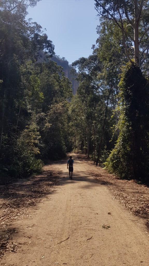
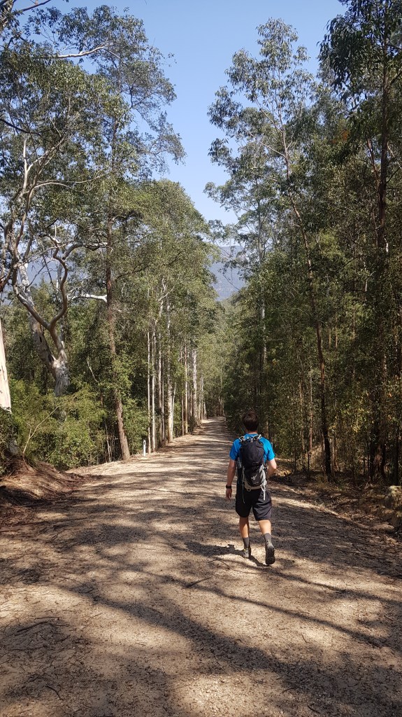
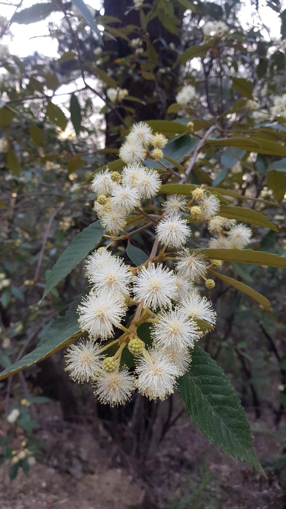
The majority of this hike is on fire trail, 13 km of it in fact so if you aren’t into hiking along fire trails this walk may not be for you. The fire trail start off on a gentle gradient descending down into the valley and after about 1.5 km begins to descend more rapidly.


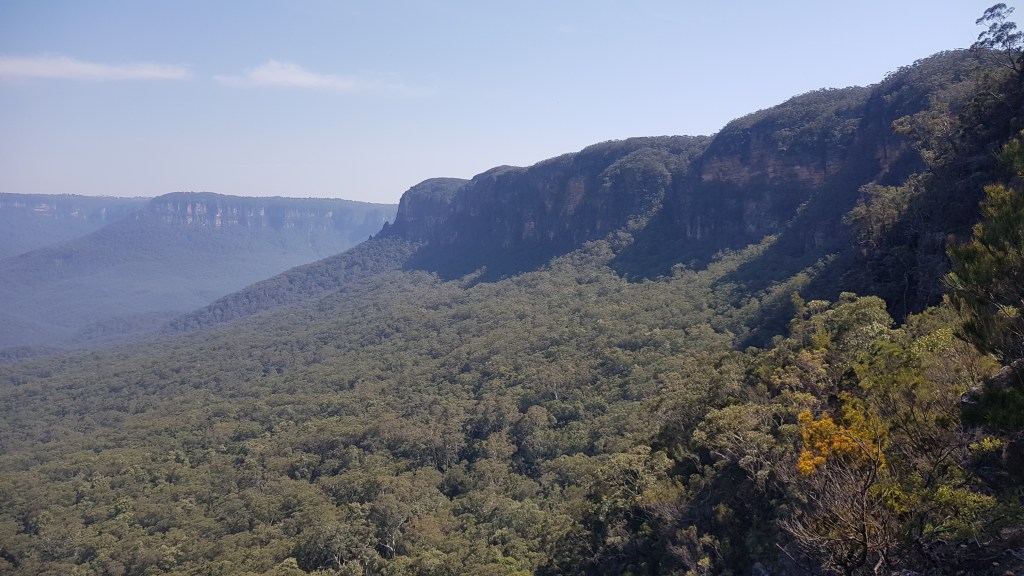
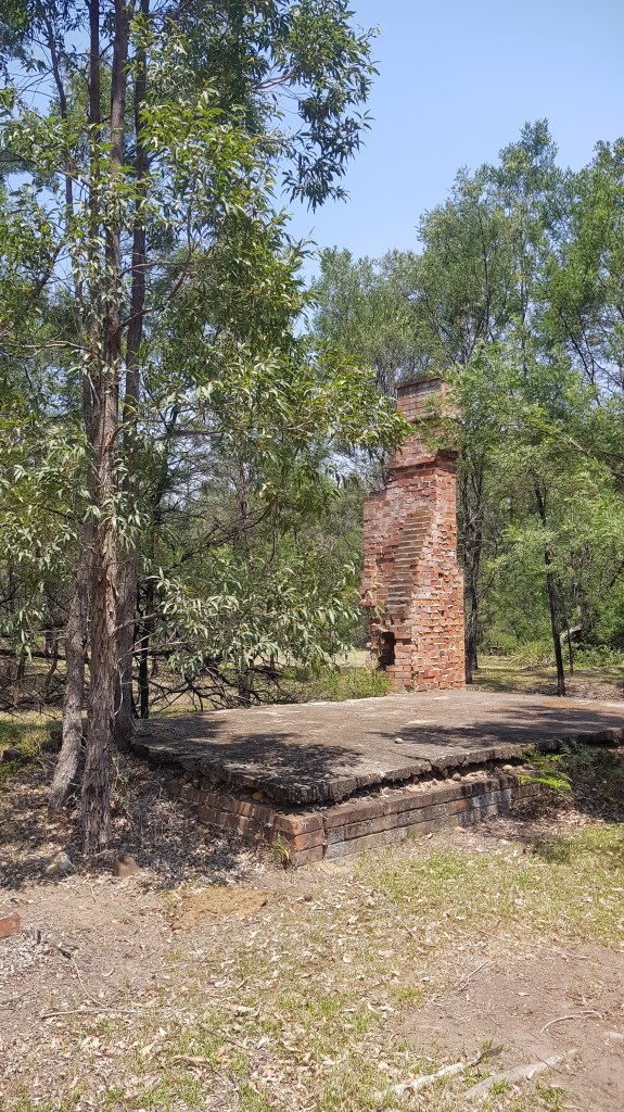
On the hike down into the valley we had fleeting glimpses across the valley and of the surrounding cliff lines. We could even see the township of Katoomba with the towering chimney stack of the Carrington Hotel towering above the tree line. This isn’t a walk of grand views since most of the hike is down along the valley floor however the glimpses you see make it even more special.
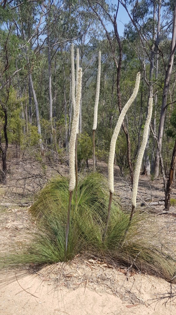
There is plenty of old growth forest in this section of the blue mountains with some of the largest Eucalypts I’ve ever laid my eyes on towering overhead.
As we reached the valley floor the bush opened up and the flies and heat intensified. Both Adam and I had made the rookie error of forgetting our hats and we paid for it, the sun was beating down overhead and it the temperature soared to a scorching 32 degrees. I was grateful that we had both packed a plentiful 3 liters of water each.

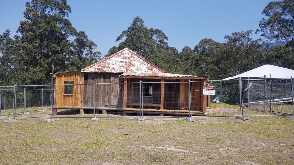
There is some interesting history on the floor of the Kedumba Valley, you will reach a marked turn off to Kedumba Slab Hut, it is well and truly worth the 100m detour to check it out. Slab Hut is the original residence of the Maxwell family who lived on the land as pastoralists until the 1950’s. There is also a towering gum tree not far from the hut which makes a great lunch spot and reprieve from the sun. You will also have the opportunity to see a stand of rare Camden White Gums which are endemic to this area. Unfortunately this area of the Blue Mountains is under threat from the rising of Warragamba Dam. Should this project go ahead the dam will be raised 14m and some of our endangered flaura and fauna, such as the Camden White Gum would be in real danger of being lost forever. See how you can help in our notes below.


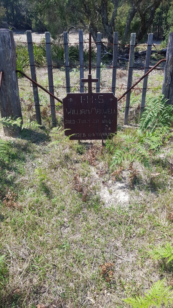
After lunch we continued on through the heat, passing William Maxwell’s grave.
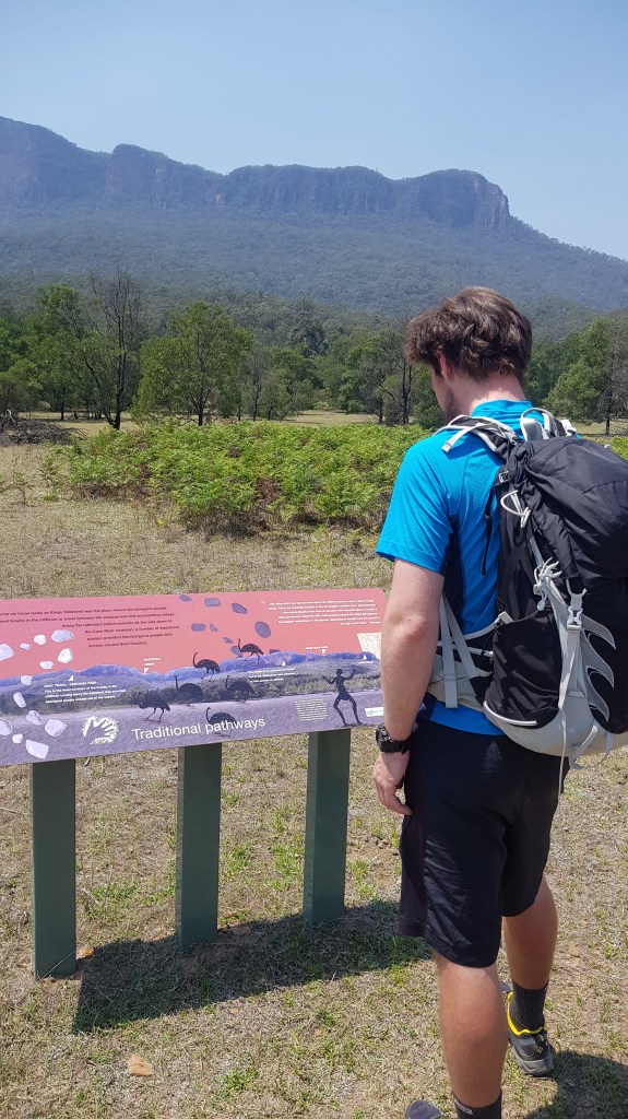
Rounding the corner onto the Cedarland Ridge Trail where some signage provided information on the history of indigenous people local to the area. I found it interesting to learn that the Aboriginal name for Mt. Solitary is Muumu, meaning large, which makes perfect sense when you see it looming over the valley.
A little further down the Cedar Ridge Trail is the Kedumba Campground, it is a lovely secluded spot situated on the old Maxwell pastural land a stones throw from the Kedumba River. To this day you can see ruins of the old settlement buildings, it makes an interesting place to camp, being able to take in some history and nature simultaneously.

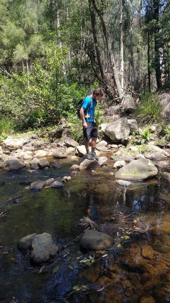
The trail continues over the river and begins to climb, after a km or so we reached the junction to Solitary Mountain. This loop trail doesn’t actually summit Mt. Solitary however you can do so in a day walk from Katoomba or alternatively extend this itinerary to include Mt. Solitary. Check out our alternative Route suggestions below. From the Mt. Solitary turn off the trail turns into single track and we enjoy some rugged Australian bush walking. It felt good to be back on single track in the Australian bush.


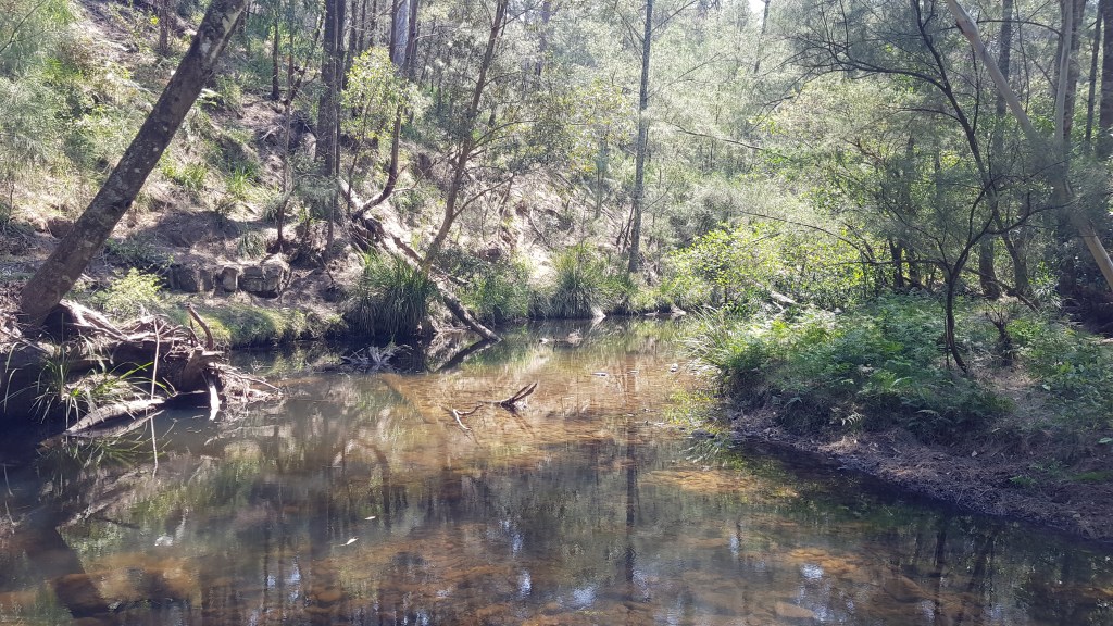
The trail undulates a little before dropping steeply back down to the Kedumba River. As we approached the river a couple of startled water dragons dove in for safety. Strange as it may seem I had never actually seen a water dragon in the water before this point so I thoroughly enjoyed seeing how proficient they were in the water.


From the river we reluctantly began our climb back out of the valley. It was beautiful walking however given the heat it was tough going and a few breaks were in order to avoid the onset of heat stroke.

By the time we made it back to the fire trail junction things had cooled down a little and the number of flies had reduced substantially. I’m not sure whether it was because we had climbed a little out of the valley or because it was getting later on in the day but it was a welcome relief.

I was relieved to make it back to the intersection of Kedumba Valley Road, knowing all we had between us and the car was a few km’s of uphill fire trail.

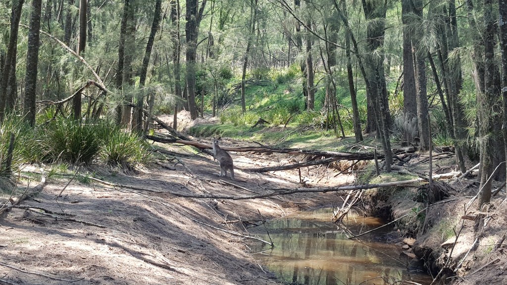
We spotted an immense amount of wildlife on the trail, lyre birds, goanna, black cockatoo, Rozella, kangaroo, skinks, water dragons and a myriad of other bird life. I think this is due to the trail being quieter than some of the more popular cliff top walks of the Blue Mountains.
Threat to this spectacular area of the Blue Mountains
As touched on above, The NSW Government has decided to raise Warragamba Dam 14 metres for flood mitigation in the Hawkesbury-Nepean Valley. The project is set to cost $700 million dollars and would destroy vast tracts of the Blue Mountains National Park and hundreds of Gundungurra Aboriginal heritage sites, all in the name of injecting another 130,000 people to live on western Sydney floodplains.
There are 48 threatened plant and animal species which inhabit the proposed inundation area. The Camden White Gum, Kowmung Hakea and near-extinct honeyeaters are found in the upstream inundation area. If the dam were raised, many of these species would likely become extinct.
To find out more about the raising of the dam visit the National Parks Association of NSW (NPANSW). The NPANSW advises that we can help by;
- Contacting our local MP to tell them we disapprove of the drowning of 4,700 hectares of World Heritage Listed Blue Mountains National Parks
- Sign the online petition at www.wildrivers.org.au/petition
- Volunteer our skills with Wildrivers. If you have some skills you feel you can contribute to the campaign shoot the team an email at wildrivers@colongwilderness.org.au
Walk information
Location: Wentworth Falls, Blue Mountains
Distance: 19km
Style: Loop Track
Time: 6 hours, including generous breaks to escape the heat, eat lunch and take in some history
Terrain: The majority of this hike is on fire trail, about 13km so if you don’t like hiking along fire trails this hike may not be for you. There are some steep sections on the single bush track which are of moderate difficulty. There is a total elevation gain of 1,010m as the trail drops down into the valley and climbs back out again.
Transportation: 1 car. You will need your own car to get to the start of the trail. There is no public transport available.
Navigation and maps: We used AllTrails for nativation. To download the maps for offline use you need to pay an annual subscription fee of around AUD$30. It was the first time we have used AllTrails and whilst the information isn’t as comprehensive nor the maps as detailed as guthook guides it is a helpful tool to make sure you don’t get lost. Checkout the AllTrails map here.
Water: There is no potable water on the trail so bring plenty of water with you. The trail crosses two potential water sources (of the Kedumba River) however this water must be treated before consumption.
Good for: Wildlife watching, trail running.
Other tips: The valley is quite exposed and can get quite hot so make sure you take plenty of water, wear sunscreen and bring a hat.
Alternative route options
- Turn it into an overnighter and camp by the river at Kedumba Campground where there are toilets, camp bbq’s and picnic tables available. It would also be possible to pitch a single or 2 person tent at the Solitary Mountain/ Kedumba River Junction.
- Start your walk via the Sublime Point Trail at Leura, to take in some beautiful cliff top views as you make your way down into the valley. This would add some mileage to your walk so consider making it an overnight hike.
- Combine the Kedumba Valley loop with the Mt. Solitary walking track for a multi-day hike through this historic area.
The possibilities are endless so get out your maps and start exploring!

You must be logged in to post a comment.